Well that was quite a day, with unexpected pleasures and only a handful of near death experiences.
It began quietly enough in a sunny, almost empty campsite where we picked up our freshly baked maple-pecan pastries and then did loads of washing and added blog photos and trampolined like a mad thing (guess who did what…). There was also a bit of sitting and reading and plotting the next few days over an impossible-to-fold map. It was noon by the time we pulled out, but somehow these long days lend themselves to late starts as there is so much good light in the evening that you naturally want to do things in it.
Forty minutes down the road is Oppdal, a tidy little mountain town, and the gateway to Dovre national park. In the tourist office the patient, enthusiastic and utterly cheerful woman behind the desk pointed out a number of hikes we could do in the area, including the one up the mountain which dominates the town. “Take the steep route” she said with a big smile, “Its the best and goes to the best view in the whole area – its only 7k”.
 |
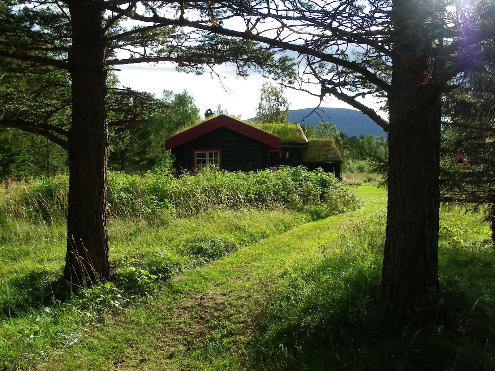
| The home of the last man to live from hunting and fishing on the mountain. |
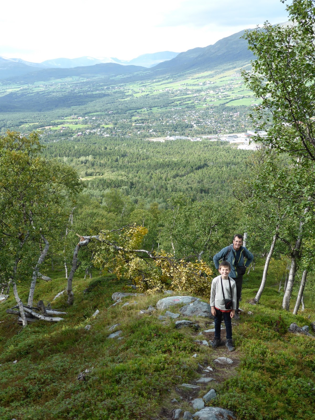
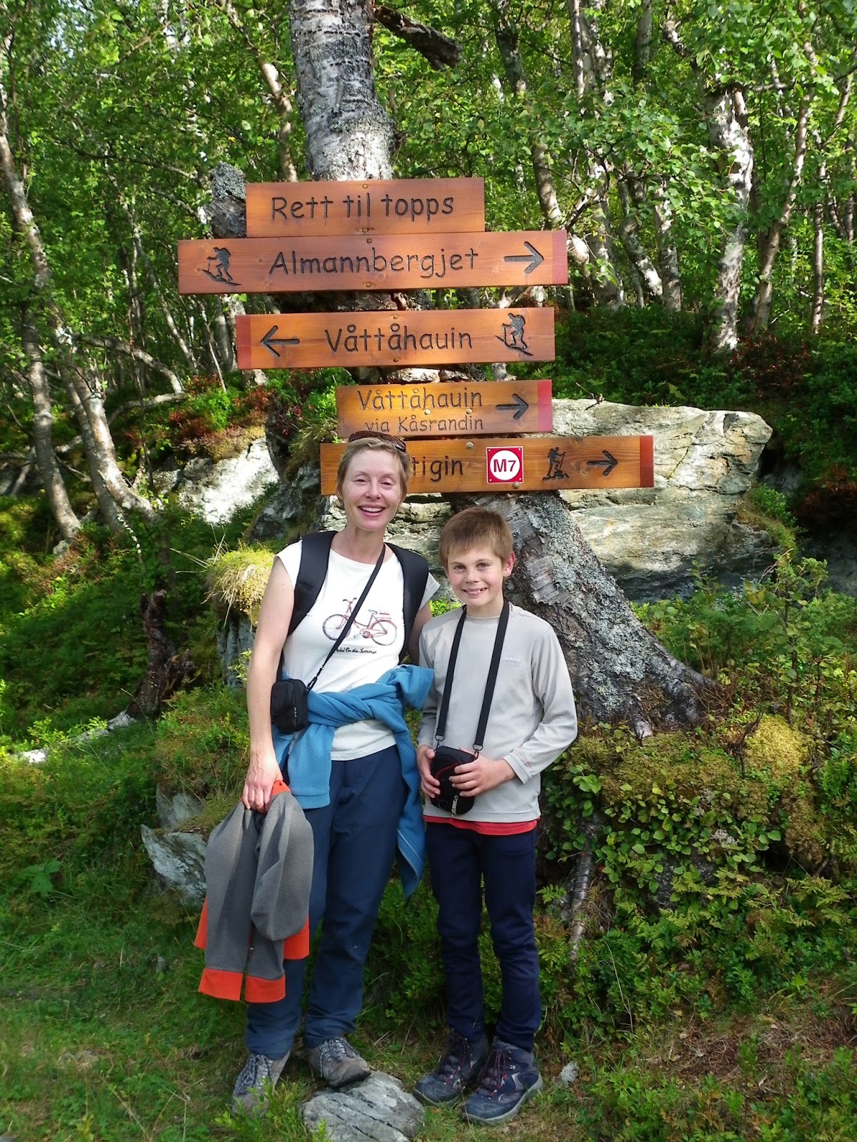
So armed with a trail map (which even showed good places to stop for coffee en route) we set off for the start of the hike. The sun was sort of out, and there was a crisp breeze as we set off through the woods at the base of the mountain. Tom was skipping and hopping over the rocky track and the path was clearly marked.

After about half an hour of walking we came to the signpost which directed us to the summit 1340 meters up and there was a lot of stuff and nonsense about “at your own risk”. The tourist info lady had told us that just before the summit the track split into easy and difficult routes and to “take the difficult – its much more fun!”. She had also warned us that we could only ascend the steep trail, as it was too easy to dislodge rocks coming down it. There was a much gentler descent on the other side.
So, up we went and it was a steep climb for sure, and we were all huffing and sweating but the trees began to thin out and the views were spectacular. Slowly but surely the path got even steeper until we were using tree branches and roots to heave ourselves up the most vertical bits, but the comforting red flashes were still there marking out the way.

When we rose above the tree line, we stopped for a break in a large rocky cleft where a crow shouted at us, the sound echoing off the cliff walls. It soared off over the woods where we had started out far, far below. It was steep enough now that we were placing our feet fairly carefully, and trying not to concentrate on just how close the dropoff was to the path. Tom of course was oblivious to this and strolled ahead.
The wind picked up and gusted hard enough to make me suddenly crouch against the rock. This was not hard to do given that the rock face we were now scaling was about eighteen inches away from my chest. P and I gradually realised that we had reached a point of no return where it was too risky (not to mention terrifying) to climb down. So we heaved ourselves up one step at a time, not looking down or up and willing ourselves on. The rocks on the path were loose and slippery and the trail switched back on itself, sometimes following ledges that forced us to sidestep, clinging onto the mossy plants for balance. Tom still appeared to have no worries whatsoever about our precarious route. At one point he said “Dad, I am a bit scared…that the route down won’t be steep enough”.

At one terrifying switchback we passed a wooden trail marker illustrated with a coffee cup, to show that this was a good place for a relaxing break. This made me think that Norwegians are really quite different from the rest of us.
Up and ever more up we wound with the wind blasting us with occasional, terrifying gusts. P and I never had less than two hands holding on at any one time. Sometimes more. We weren’t proud either; if a particular route required crawling on our knees, so be it.
 Further on was the sign offering us the choice between the “easy” and “steep” routes to the top. To their credit, Tom was completely up for the steep route, and Philippa was prepared to give it a go too, but given that the route thus far hadn’t even registered as more than mildly challenging by the sunny lady at tourist info, I decided that I really didn’t want to find out what she regarded as steep. We took the “easy” route, and never have speech marks been more appropriate. It was a route that would make your average Mountain Goat re-evaluate its life choices; a route of sheer and winding narrowness which required much muttering under the breath.
After about forty five minutes of this we popped over a ledge and were, mercifully, at the rounded summit, with the wind howling around a large radio mast that had been our goal. Around us in all directions were snow-splashed mountains, separated by broad green valleys and forest. We sat in the lee of a huge cairn and ate chocolate and nuts, not saying very much and thankful to have finally been able to stop climbing, but also rather proud of ourselves.


The route down was knee-hammeringly steep but on a path down a broad flank of the mountain with no deathly drops to have to not think about. The sun shone and birds flitted and every now and then one of us would stop to eat a handful of bilberries. Before long we had regained our original path in the woods and after 9k and nearly 2700 meters of vertical travel we were back at Thor. It was far and away the toughest hike we have ever done, and a reminder that when Norwegians talk about gentle ambles through the wilderness, it may be wise to strap on some crampons.
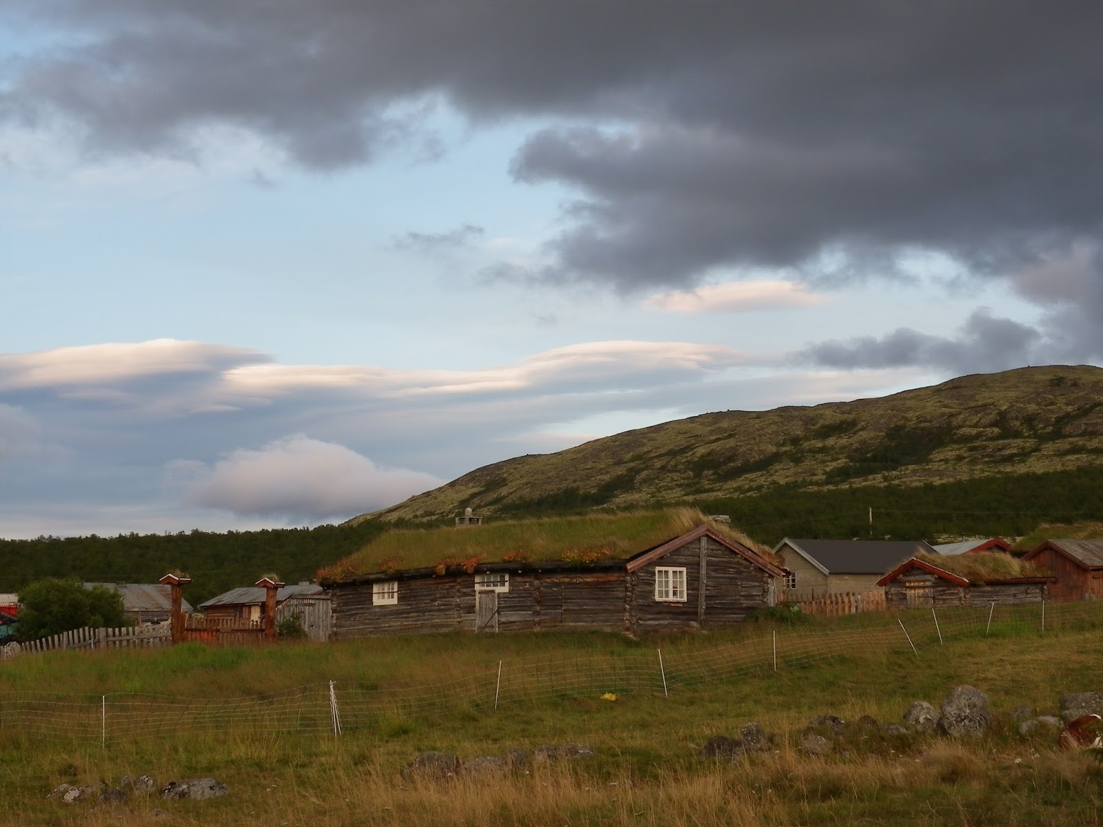
We struck south again to the Dovre national park passing some wonderful old farmhouses, some still in use, others grey-timbered and abandoned. We were still following the railway line and some of the wooden stations were brilliantly over the top with big brightly painted shutters and turf roofs.
There is no free camping allowed in Dovrefjell so just south of Hjerkin we pulled onto a dirt road down to a campsite which is next to a lovely collection of old log-cabin farm buildings. Inside the small cafe, eating and joking, was a big tableful of army lads who the owner said came up every summer to clear an old army firing range of unexploded ordinance. He said the project is expected to last until 2020.
It is a tranquil spot, and after some more of Lofoten’s finest fishcakes followed by “Star Trek IV” we collapsed gratefully into beds, dreaming of clinging to sheer walls of polished granite. And trampolines.
 After about half an hour of walking we came to the signpost which directed us to the summit 1340 meters up and there was a lot of stuff and nonsense about “at your own risk”. The tourist info lady had told us that just before the summit the track split into easy and difficult routes and to “take the difficult – its much more fun!”. She had also warned us that we could only ascend the steep trail, as it was too easy to dislodge rocks coming down it. There was a much gentler descent on the other side.
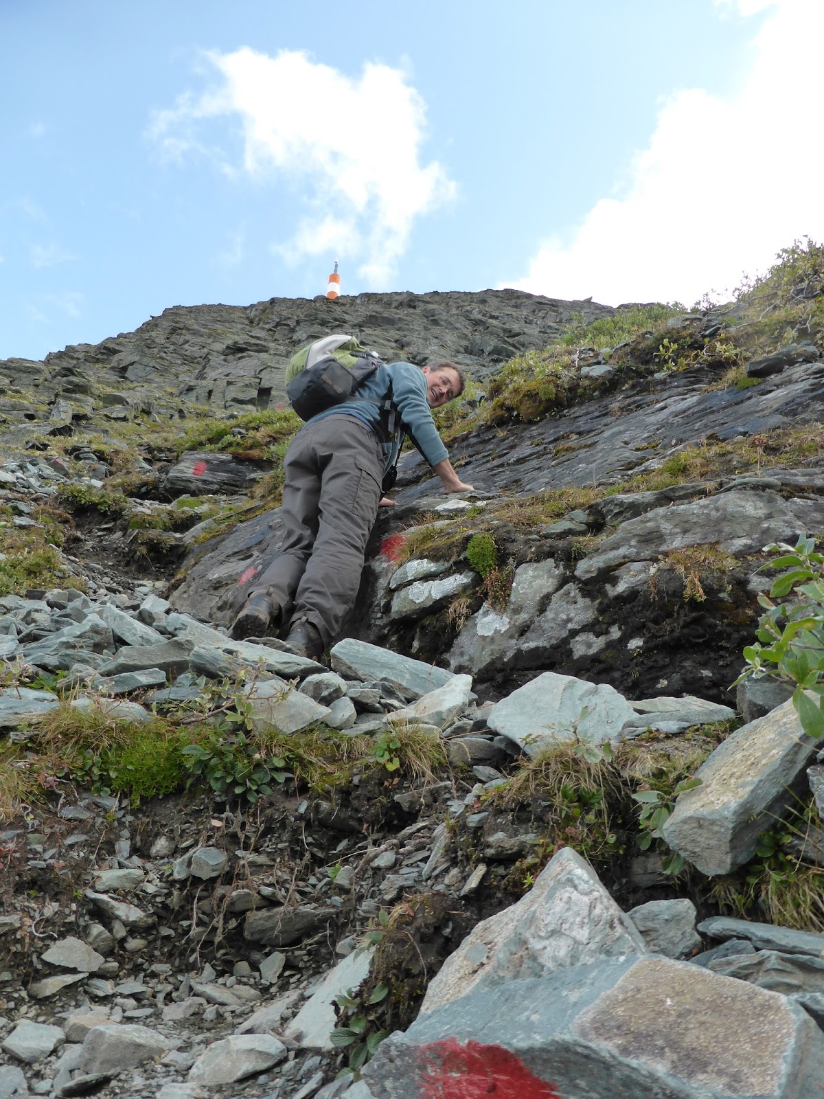 When we rose above the tree line, we stopped for a break in a large rocky cleft where a crow shouted at us, the sound echoing off the cliff walls. It soared off over the woods where we had started out far, far below. It was steep enough now that we were placing our feet fairly carefully, and trying not to concentrate on just how close the dropoff was to the path. Tom of course was oblivious to this and strolled ahead.
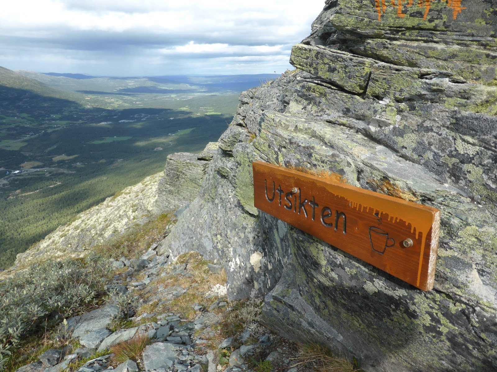 At one terrifying switchback we passed a wooden trail marker illustrated with a coffee cup, to show that this was a good place for a relaxing break. This made me think that Norwegians are really quite different from the rest of us.
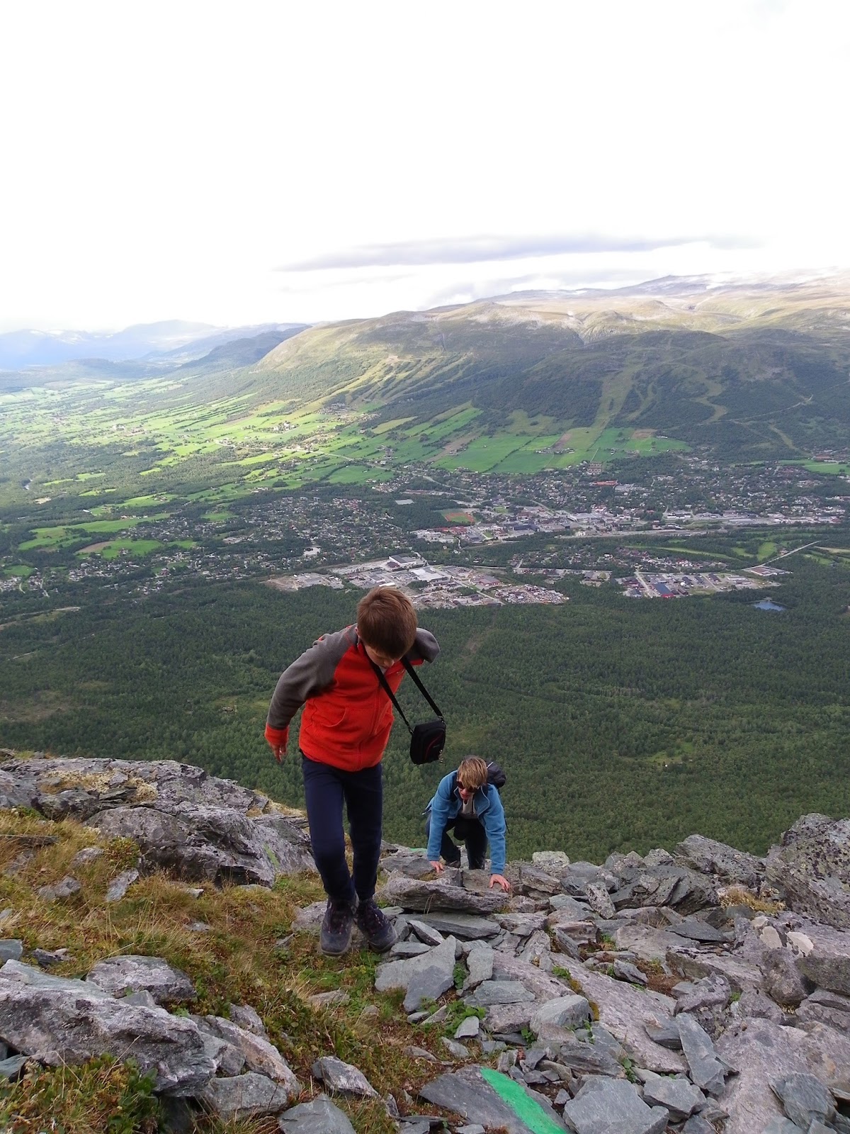 Further on was the sign offering us the choice between the “easy” and “steep” routes to the top. To their credit, Tom was completely up for the steep route, and Philippa was prepared to give it a go too, but given that the route thus far hadn’t even registered as more than mildly challenging by the sunny lady at tourist info, I decided that I really didn’t want to find out what she regarded as steep. We took the “easy” route, and never have speech marks been more appropriate. It was a route that would make your average Mountain Goat re-evaluate its life choices; a route of sheer and winding narrowness which required much muttering under the breath.
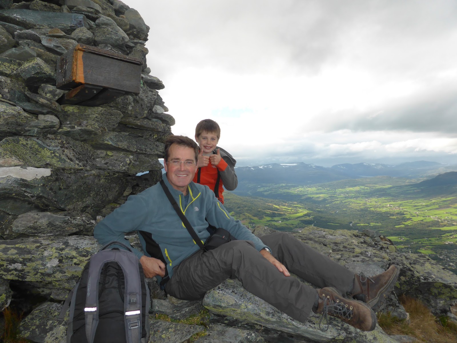
 The route down was knee-hammeringly steep but on a path down a broad flank of the mountain with no deathly drops to have to not think about. The sun shone and birds flitted and every now and then one of us would stop to eat a handful of bilberries. Before long we had regained our original path in the woods and after 9k and nearly 2700 meters of vertical travel we were back at Thor. It was far and away the toughest hike we have ever done, and a reminder that when Norwegians talk about gentle ambles through the wilderness, it may be wise to strap on some crampons.
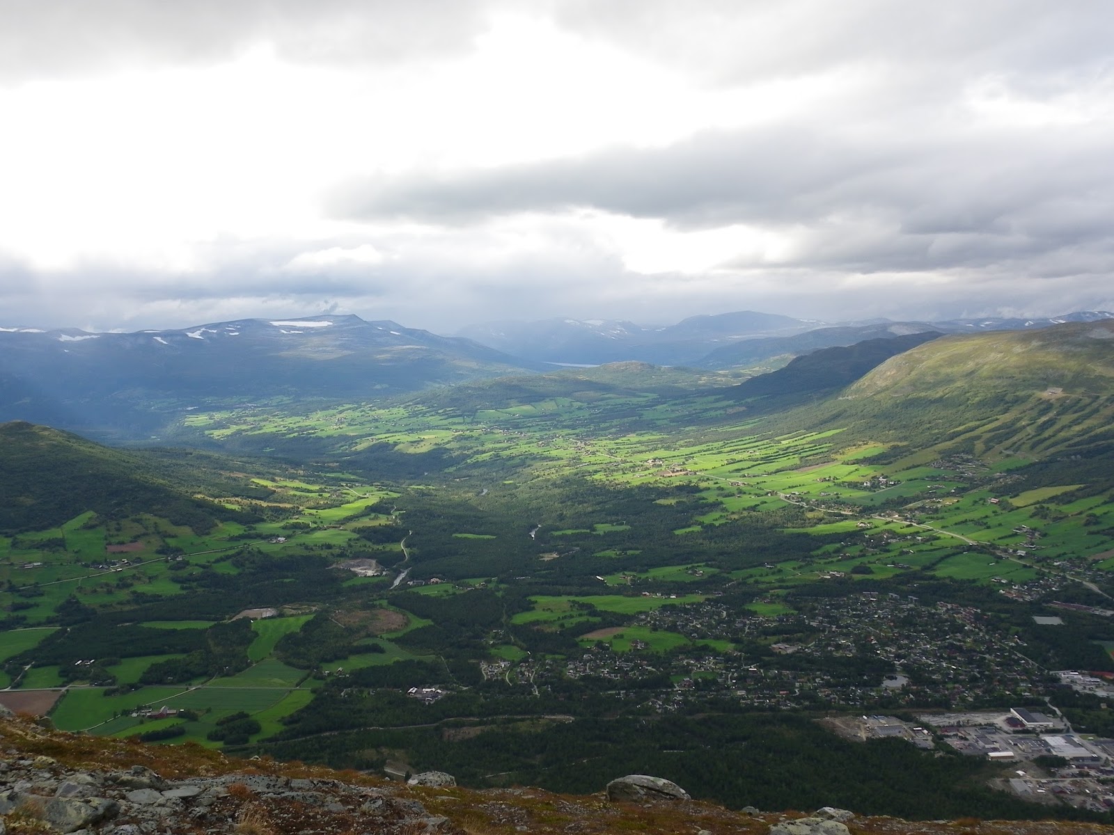

Leave a comment